Australian researchers predict strongest El Niño since 1950
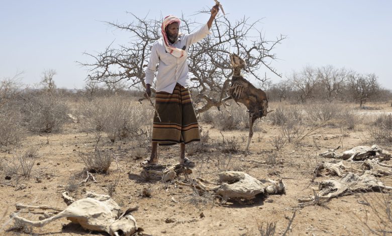
AUSTRALIA: DATA suggests a very strong El Niño approaching, with higher temperatures predicted to bring droughts to some areas and flooding to others.
This year’s El Niño weather event could be the strongest since 1950, according to the Australian Bureau of Meteorology (ABM).
“Forecasts are pointing towards a strong to very strong El Niño event, based on the extent of warming in the central tropical Pacific. The majority of models indicate this event is likely to peak at levels among, or above, the highest observed since 1950,” the Bureau predicts.
Data released by the ABM reports July’s Southern Oscillation Index (SOI), a key indicator of El Niño, at -29.1, with an El Niño usually signified by sustained readings of -7.
The SOI is a standardised index based on the observed sea level pressure differences between Tahiti and Darwin, Australia.
The SOI is one measure of the large-scale fluctuations in air pressure occurring between the western and eastern tropical Pacific during El Niño and La Niña episodes.
Fallout for Africa
Oxford Economics Africa published a new report based upon the data which elucidates the potential consequences for Africa.
“The latest monthly Southern Oscillation Index (SOI) reading for July has fallen to its lowest level in four decades, increasing the likelihood that the El Niño in 2026–2027 could rank among the strongest on record. This poses significant risks for Africa, where drought and flooding could reduce agricultural output and weigh on economic growth.”
The 2026/2027 El Niño is predicted to bring “heat and drought to some areas and extreme flooding to others” it says.
Scientists have previously predicted a ‘Godzilla’ El Niño event this year with wide-ranging consequences predicted.
“Southern Africa and parts of the Sahel are particularly vulnerable. While recent bumper harvests in some areas may provide a degree of resilience, the overall economic and humanitarian impacts could be severe,” says Oxford Economics Africa.
ALSO READ: TMA forecasts prolonged cold season, warns of possible El Niño
A “very strong” El Niño means that sea surface temperatures in the Pacific regions are more than 2°C above average, weakening or even reversing easterly trade winds.
El Niños are known to increase rainfall in East Africa, causing flooding, and diminish rainfall in Southern Africa and the Sahel region, causing drought.
Furthermore, the World Meteorological Organization predicts that heightened temperatures may be increased further by the likelihood of a positive Indian Ocean Dipole – a natural climate pattern defined by the difference in seasurface temperatures between the western and eastern tropical Indian Ocean – intensifying the dry season in the Sahel and Southern Africa.
Coming at a time of already heightened global energy and fertiliser prices, Oxford Economics Africa says pressure on the agricultural sector could trigger higher food import prices and rising demands for subsidies and disaster relief. Maize production fell by more than 50% in some countries during the 2023/24 El Niño, leading to several national disasters being declared.
“Near-term economic growth prospects” in the Sahel, Southern, and East Africa are expected to be weakened, as the El Niño’s effect on rainfall is “likely to weigh on agricultural growth, water supply, and power generation”.