What ‘above-average rainfall’ really means as 2026 Vuli season nears
DAR ES SALAAM: FOR many Tanzanians, the phrase ‘above-average rainfall’ may sound like a warning that rain will fall heavily almost every day throughout the season.
But according to weather experts, the phrase has a more precise scientific meaning.
It is based on historical rainfall records, location, season and the probability of different rainfall outcomes.
The distinction is becoming increasingly important as Tanzania prepares for the 2026 October-December, or Vuli, rainfall season, which the Tanzania Meteorological Authority (TMA) says will be significantly influenced by a strong El Niño.
TMA forecasts above-average to average rainfall across much of the northern coastal belt, northeastern highlands, Lake Victoria basin and northern Kigoma. The rains are expected to begin around the fourth week of September and first week of October in the Lake Victoria basin before spreading gradually to other areas.
The forecast also points to increased rainfall in November, while some out-of-season rains may continue into January 2027.
But what exactly does ‘above average’ mean? How many millimetres of rain does it represent? Does it mean heavy rain every day? And how is a seasonal forecast different from the weather forecast people receive for tomorrow? A weather expert with TMA, Alfred Kondowe, provides some answers.
“Above average does not mean one fixed amount of rainfall for the entire country. Instead, it means that the rainfall expected in a particular place is likely to exceed the amount that normally occurs there during a particular period,” he said.
What is ‘normal’ rainfall?
Mr Kondowe explained that meteorologists establish what is considered normal by comparing current expectations with long-term historical records.
For example, if Dar es Salaam normally receives a certain amount of rainfall during October, November and December, a seasonal total expected to exceed that historical level would be classified as above average.
The important point is that the average is not the same everywhere. A rainfall amount considered high in one region may be normal in another because Tanzania has different climatic zones.
Mr Kondowe said meteorologists currently use a 30-year reference period, from 1991 to 2020, to calculate the climate normal used for comparison. “For the standards of the World Meteorological Organisation (WMO), the period we are currently using is from 1991 to 2020,” he said.
Thus, when meteorologists assess the October-December season, they examine rainfall records for those three months over the 30-year period and use the resulting climatology to establish what is normal for each location.
That historical benchmark is essential because there is no single definition of ‘normal rainfall’ that applies equally to Dar es Salaam, Tanga, Arusha, Kilimanjaro, Mwanza or Kagera.
Rainfall patterns are influenced by geography, elevation, proximity to large water bodies, prevailing winds and other atmospheric conditions.
That is why a forecast of aboveaverage rainfall should always be understood in relation to a particular location.
It also explains why asking how many millimetres above average Tanzania will receive cannot be answered with one national figure.
Mr Kondowe said seasonal forecasts are probabilistic and are designed to describe an expected tendency rather than provide an exact rainfall total months in advance.
“If we say above average, you cannot give a number with certainty because this is a long-range forecast,” he said.
The actual amount can only be established after the season has occurred and rainfall observations have been collected and analysed.
Above average does not mean rain every day
This distinction matters because the public can easily interpret ‘above average’ as meaning that every day will experience heavy rainfall.
That is not what the forecast means. Mr Kondowe said a season can end with rainfall above its historical average even if many days are completely dry, provided rainfall during a number of days is sufficiently high to push the seasonal total above normal.
“Whenever you talk about a season, it does not mean that every day there will be rain. You can make the seasonal total and find that rainfall was very high, but that rainfall may have been contributed by only a few days during the months concerned,” he said.
The 2026 forecast illustrates this point.
The Vuli season is expected to receive more rainfall particularly in November and December, meaning the seasonal total could be pushed upward by rainfall during particular periods rather than continuous rain throughout the season.
This is an important distinction for farmers, traders, construction companies, transport operators and households.
A seasonal forecast tells people what kind of overall conditions they should prepare for. It does not tell a farmer that it will rain every day from October to December.
A season can have an above-average rainfall total while still containing relatively long dry spells.
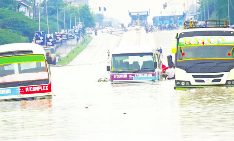
Equally, a location can experience a few episodes of very intense rainfall capable of causing flooding even when its overall seasonal total is not exceptionally high.
The WMO uses probabilistic seasonal forecasts to show whether rainfall is more likely to fall into abovenormal, near-normal or below-normal categories compared with local climatology.
The category with the highest probability is not a guarantee of what will eventually occur.
El Niño is not rain
As Tanzania prepares for the coming season, TMA weather analyst Ramadhani Omary said there is also a need to understand what El Niño actually is, particularly because the phenomenon is sometimes mistakenly used to mean rainfall itself.
“When we talk about El Niño, we do not necessarily mean rain. El Niño is a weather system,” Mr Omary said.
El Niño refers to an increase in seasurface temperatures in the central and eastern tropical Pacific Ocean.
When this warming persists, it can alter atmospheric circulation and weather patterns in different parts of the world.
“For Tanzania, for example, we expect an increase in rainfall, particularly towards the end of the year and the beginning of the following year, meaning from October to January of the following year. That is when we talk about El Niño conditions,” Omary said.
He stressed that El Niño itself is not rain and that its effects differ from one location to another.
“Some people may be preparing to cope with reduced rainfall and drought, while others may be preparing for increased and intense heat. Some countries or communities may, instead, be preparing for extremely cold conditions,” he said.
The impacts of El Niño, therefore, cannot be understood simply by looking at the strength of the Pacific warming. Other climate systems, including conditions in the Indian Ocean, can modify its effects.
ALSO READ: Vuli rains loom as TMA warns of dry spells
Why the 2026 El Niño matters
The current El Niño is attracting considerable international attention. In its latest update issued on September 3, 2026, WMO said El Niño was firmly established and expected to strengthen into a very strong event in the coming months.
WMO put the likelihood of the event persisting through February 2027 at nearly 100 per cent.
The WMO update said the Niño 3.4 sea-surface temperature anomaly had risen to about 2.0°C above average in July, with weekly values reaching approximately 2.2°C to 2.6°C above average between late July and mid-August.
The International Research Institute for Climate and Society (IRI) at Columbia University reported in August that the July Niño 3.4 value was 2.03°C, while the weekly value centred on August 12 reached 2.7°C.
Its model ensemble showed strong agreement that El Niño would intensify, with 25 of 26 models placing the event in the ‘very strong’ category for October-December 2026. WMO’s September seasonal outlook projected the Niño 3.4 sea-surface temperature anomaly to average about 3.6°C during September-November, with the intensification expected to peak around November-December.
A positive Indian Ocean Dipole is also expected to develop, with a seasonal mean of about 0.9°C. These global indicators help explain why meteorologists are paying close attention to the coming rainfall season.
However, WMO also stresses that a very strong El Niño does not produce identical impacts everywhere.
Its effects vary by location and season and can be modified by other climate drivers, including conditions in the Indian and Atlantic oceans.
El Niño, the Indian Ocean and Tanzania
For East Africa, the situation is also influenced by the Indian Ocean Dipole (IOD), a climate pattern involving differences in sea-surface temperatures between the western and eastern tropical Indian Ocean.
Mr Kondowe said these largescale systems are among the key factors considered when preparing seasonal forecasts.
“When we prepare a seasonal forecast, we look at large weather systems such as El Niño,” he said, adding that meteorologists also examine sea temperatures and the Indian Ocean Dipole.
Tanzania’s geographical position makes the Indian Ocean particularly important. Meteorologists, therefore, do not simply take an El Niño forecast and automatically translate it into a rainfall prediction for Tanzania.
Instead, they assess several interacting climate drivers to determine how those systems are likely to affect the country.
For the coming Vuli season, TMA identifies the northern coastal belt, including Dar es Salaam, Tanga and Coast, Zanzibar; northern Morogoro; the northeastern highlands of Arusha, Kilimanjaro and Manyara; the Lake Victoria basin, including Kagera, Mara, Geita, Mwanza, Shinyanga and Simiyu; and northern Kigoma.
These areas normally experience two rainfall seasons, including the October-December Vuli rains.
TMA says the 2026 Vuli rains are expected to be above average to average across many of these areas and may begin earlier in the Lake Victoria basin before spreading to other areas.
The authority has also warned of possible periods of excessive soil moisture and flooding, which could affect crops and agricultural infrastructure.
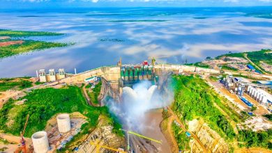
Increased water levels in rivers and reservoirs may affect water and energy infrastructure, while contaminated water can increase the risk of some disease outbreaks.
What the forecast means for communities
For farmers, therefore, an above-average forecast means more than simply carrying an umbrella. It can influence when to prepare land, which varieties to select, how to manage fertiliser and when to harvest.
For construction companies, prolonged wet conditions can delay work, damage materials and affect roads and other infrastructure.
For livestock keepers, increased rainfall can improve water and pasture availability, although excessive rainfall can also create new risks.
For communities living near rivers and flood-prone areas, the forecast is a warning to strengthen preparedness rather than wait for flooding to occur.
Mr Omary recalled that during the 2023/24 season, TMA issued information and warnings about the possibility of increased rainfall between October and December and into January of the following year.
He said some people ignored the information because they believed the forecast was inaccurate, but the resulting impacts were significant, particularly for those who had not prepared.
He urged the public to take weather information seriously and use it to make timely decisions.
At the same time, he cautioned against interpreting an above-average seasonal forecast as a prediction of continuous heavy rain.
“Increased rainfall does not mean that there will be heavy rains continuously from the beginning to the end of the season. There will be periods of heavy rainfall, periods of normal rainfall and, at times, dry spells within the season,” he said.
TMA will continue monitoring conditions and issuing updates when there are indications of potentially heavy rainfall, he added.
Why forecasts change
Another important question is why a seasonal forecast released months in advance can sometimes change. Mr Kondowe explained that weather operates across different timescales.
Seasonal forecasting examines largescale climate drivers that influence weather over several months, while daily forecasting focuses on smaller and more localised atmospheric systems.
A seasonal outlook may consider El Niño, the Indian Ocean Dipole, ocean temperatures and large-scale wind patterns.
A daily forecast can examine local features such as mountains, lakes, pressure systems, moisture and smaller atmospheric disturbances.
This explains why two places relatively close to each other can sometimes receive very different rainfall on the same day. The two types of forecasts also serve different purposes.
A farmer may use a seasonal outlook to prepare land and select crops, but rely on a short-range forecast to decide whether to apply fertiliser tomorrow.
A construction company can use a seasonal forecast to plan project timelines, while a daily forecast can help determine whether work should proceed on a particular day.
Similarly, a household planning an outdoor event month in advance can use the seasonal outlook to understand the broader rainfall risk.
As the event approaches, a 10-day forecast and eventually a daily forecast can provide more specific information. Kondowe said this updating process is necessary because the atmosphere is constantly changing.
For example, winds expected to bring moisture into Tanzania can be affected by changing pressure systems over the ocean, altering the movement of moisture and the timing of rainfall. This means science cannot provide the exact weather for every day several months in advance.
Instead, seasonal forecasting identifies the most likely broad pattern and gives people time to prepare, while shorter-range forecasts become more useful as the event approaches.
Preparing rather than predicting every raindrop
As Tanzania enters the 2026 Vuli season, the message is therefore not simply to expect ‘a lot of rain’.
It is to understand where rainfall is most likely, when wetter periods are expected, what risks may accompany the rains and how those risks can be managed.
WMO says the current El Niño is likely to strengthen further and persist into early 2027, while TMA forecasts above-average to average Vuli rainfall across several parts of Tanzania.
The value of the forecast will ultimately depend on how effectively that information is translated into early action.
The rain itself may be beyond human control. But the decision to prepare for it is not.