Tanzania enhances earthquake monitoring activities with geological survey for disaster preparedness
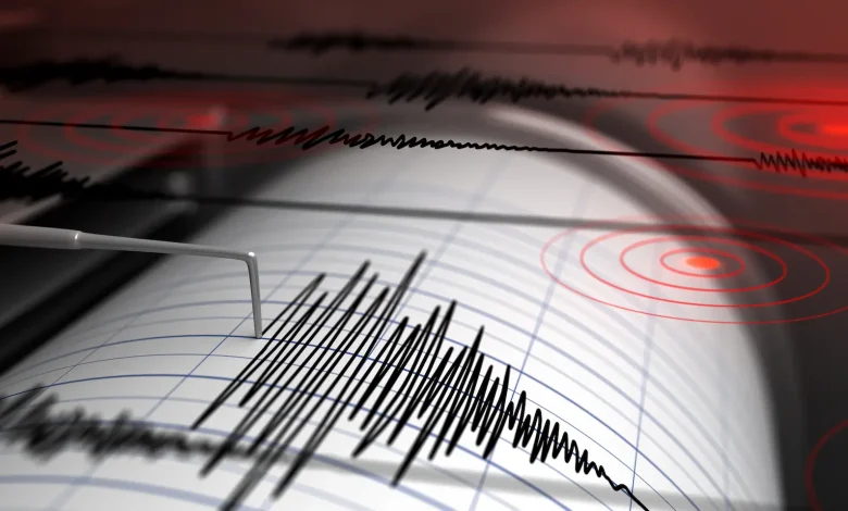
DODOMA: THE Ministry of Minerals said Tanzania will continue to enhance earthquake monitoring activities alongside public education programmes on disaster preparedness to respond to natural disasters as per the country’s geological survey
A statement issued by the ministry today, May 20, 2026, in Dodoma stated that the government aims to strengthen early warning systems to protect lives, property and critical infrastructure from the impacts of geological hazards.
Elaborating, the minister said as part of its implementation plan, the Tanzania Geological Survey will collect seismic data from four permanent monitoring stations located in Arusha, Dodoma, Geita and Mbeya.
He said the data will be processed to update the national earthquake epicentre maps, improving understanding of high-risk zones and supporting better preparedness and response planning.
ALSO READ: EFTA bond over subscribed strong confidence
“The agency will also continue maintaining and upgrading modern seismic monitoring equipment to ensure accurate and timely data collection. These improvements are expected to enhance the capacity of geologists to analyse earthquake trends and provide early and reliable information to authorities and the public,” he said.
In addition, he said the Tanzania Geological Survey will intensify public awareness campaigns on disaster risk reduction through publications, seminars, radio and television programmes, as well as digital platforms. The education efforts aim to equip citizens with knowledge on precautionary measures before, during and after earthquakes and other geological disasters.
The initiative is among key priorities outlined by the Ministry of Minerals for the 2026/2027 financial year, as presented in Parliament in Dodoma by Minister for Minerals, Anthony Mavunde.