Tanzania flood-risk map, the need to count cost before
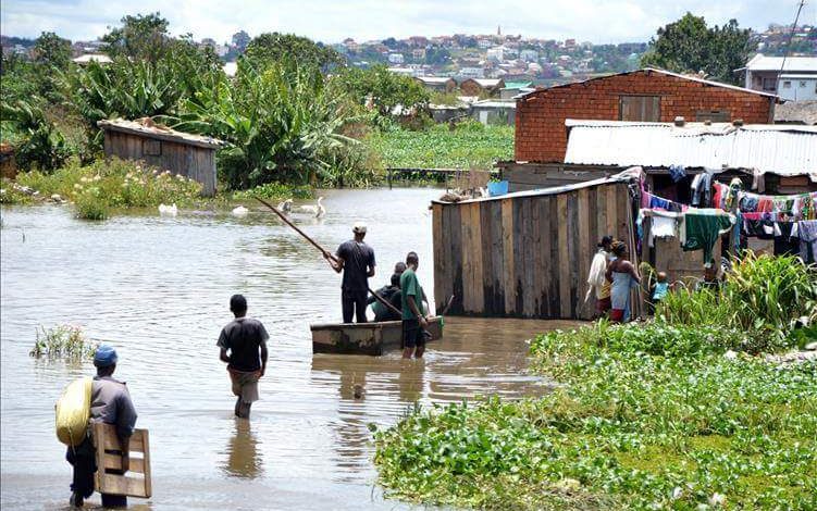
DAR ES SALAAM: FOR communities living along rivers, in low-lying neighbourhoods and across Tanzania’s flood-prone plains, heavy rain is never simply a weather event. It can mean swollen rivers, flooded homes, impassable roads, damaged bridges, disrupted businesses and, in the worst cases, loss of lives and livelihoods.
That risk is once again coming into focus as Tanzania prepares for the 2026 Vuli rainfall season, with the Tanzania Meteorological Authority (TMA) forecasting normal to above-normal rainfall across several parts of the country and warning of enhanced rainfall particularly in November.
The forecast is significant because many of the areas expected to receive substantial rains have a history of flooding. Coastal areas, river basins, low-lying plains, the Lake Victoria Basin and some highland areas have repeatedly experienced intense rainfall, with past events showing how quickly heavy precipitation can overwhelm drainage systems, rivers and infrastructure.
The concern, therefore, is not simply how much rain will fall, but where it will fall, how quickly it will accumulate and whether communities and infrastructure will be able to cope.
Presenting the climate outlook for the October-December 2026 Vuli rainfall season, TMA Director General, Dr Ladislaus Chang’a, said the season covers the northeastern highlands of Arusha, Manyara and Kilimanjaro; the northern coast, including northern Morogoro, Coast Region, Dar es Salaam and Tanga; Unguja and Pemba; the Lake Victoria Basin, comprising Kagera, Geita, Mwanza, Shinyanga, Simiyu and Mara and the northern part of Kigoma.
According to the outlook, normal to above-normal rainfall is expected across most of these areas.
In the Lake Victoria Basin and northern Kigoma, rainfall is expected to begin from the fourth week of September to the first week of October and continue through January 2027.
In the northern coastal areas, including Dar es Salaam, Tanga, northern Morogoro, Coast Region, Unguja and Pemba, rains are expected to begin during the first and second weeks of October and continue until January.
The northeastern highlands are also expected to receive normal to abovenormal rainfall during the period.
For flood-prone communities, however, the forecast carries a deeper significance because Tanzania’s rainfall history shows that intense precipitation can produce serious consequences when water accumulates faster than drainage systems, rivers and communities can absorb it.
A history of repeated flooding Tanzania’s experience with extreme rainfall stretches back decades. Records cited in TMA annual reports show repeated episodes of unusually heavy rainfall in coastal areas, river basins, low-lying plains, the Lake Victoria Basin and highland areas.
Dar es Salaam provides one of the clearest examples. In December 2011, the city recorded 60 millimetres of rainfall on December 19, followed by 156.4 millimetres on December 20 and another 43.8 millimetres on December 21. The three-day total reached 260.2 millimetres.
Other coastal areas have also experienced significant rainfall. Pemba recorded 86.1 millimetres on March 2, 2018, while Mtwara recorded 112.5 millimetres on January 1 of the same year. On February 7 and 8, 2019, Mtwara recorded a combined 177.6 millimetres.
In October 2019, several meteorological stations along the northern coast recorded rainfall between five and ten times their long-term October averages.
Such figures help explain why coastal communities remain among the areas requiring close monitoring whenever forecasts point to enhanced rainfall.
The threat is not confined to the coast. River basins and flood plains are also highly sensitive because rainfall occurring far from a settlement can eventually become a flood downstream.
In 2019, heavy flooding in Handeni was linked by TMA to rainfall in upstream districts including Kilindi, Kiteto and Simanjiro, where several seasonal rivers originate.
Lake Victoria Basin remains a hotspot
The Lake Victoria Basin also has a recurring history of above-normal rainfall.
For instance, in March 2018, most stations in the basin recorded more than 50 millimetres of rainfall, while significant above-normal rainfall was also recorded in the area in 2011.
The current forecast places Kagera, Geita, Mwanza, Shinyanga, Simiyu and Mara among the areas expected to receive normal to above-normal Vuli rainfall.
For communities around the basin, the challenge may come not only from rainfall falling directly over towns and villages, but also from the interaction between rainfall, drainage systems, wetlands, rivers and lake levels.
The situation is similarly complex in highland areas. Tukuyu recorded 232 millimetres in a single day on May 9, 2011. In March 2018, rainfall in the northeastern highlands reached twice the long-term average, while Same recorded 70.6 millimetres on March 2. Morogoro also recorded 85.3 millimetres on January 10, 2018.
These historical events demonstrate that heavy rainfall can affect very different geographical settings, from coastal cities and islands to mountain slopes, valleys and inland plains.
Climate researcher Ngongo Mang’enyi of Saint Augustine University of Tanzania says geography plays an important role in determining areas that are particularly vulnerable to heavy rainfall.
Coastal areas such as Dar es Salaam, Pwani, Tanga and parts of Morogoro are exposed to large amounts of moisture originating from the Indian Ocean.
When ocean waters are warmer, evaporation increases and more moisture enters the atmosphere. Winds can then transport moisture-laden air towards the Tanzanian coast, where atmospheric conditions can trigger heavy rainfall.
The Lake Victoria region has a different geographical influence. Kagera, Mwanza, Shinyanga and surrounding areas are affected by moisture associated with the Congo Basin. Their location near the equator also contributes to intense solar heating and evaporation, creating conditions favourable for significant rainfall.
Highland areas present another mechanism. In areas such as Morogoro, Iringa, Songwe and Mbeya, moist air rises as it encounters elevated terrain. As the air rises, it cools and condenses, potentially producing substantial precipitation.
This geographical diversity means Tanzania does not face a single flood risk. Different areas can experience flooding for different reasons, depending on rainfall intensity, terrain, drainage, soil conditions and the behaviour of nearby rivers and waterways.
El Niño and the Indian Ocean dipole
According to Dr Chang’a, the current climate system is characterised by very strong El Niño conditions, with sea surface temperatures expected to remain significantly above normal over the central equatorial Pacific Ocean.
At the same time, above-normal sea surface temperatures are expected over the western Indian Ocean relative to the eastern Indian Ocean, favouring moderate to strong positive Indian Ocean Dipole conditions.
“These ocean-atmosphere conditions are expected to enhance rainfall mechanisms over most parts of the country,” Dr Chang’a said.
The forecast does not mean that every location will experience flooding. Rainfall intensity, duration, soil moisture, drainage capacity, river levels and local topography will determine the actual impact.
But it does mean that areas already known to be vulnerable require preparation before the heaviest rains arrive.
TMA expects enhanced rainfall particularly in November, while Vuli rains that normally cease in December are expected to continue as off-season rains into January 2027 in some areas.
That extended period matters because repeated rainfall can gradually saturate soils, raise water levels and weaken infrastructure, increasing the effects of subsequent rainfall.
Risks extend beyond flooding
The consequences of excessive rainfall extend well beyond flooded homes. Dr Chang’a said agriculture is one of the sectors directly exposed. TMA warns that excessive soil moisture and flooding can affect crop growth and agricultural infrastructure, while prolonged rainfall can increase crop diseases caused by fungi, bacteria and viruses.
Crops such as potatoes, sunflower, beans, sesame, fruits and vegetables may be affected. Heavy rainfall can also interfere with harvesting and contribute to post-harvest losses.
“Farmers are therefore advised to prepare fields on time, select suitable crops and seeds in consultation with extension officers, prevent water stagnation, control erosion and protect soil fertility,” he said.
Livestock keepers may benefit from improved pasture and water availability, but excessive moisture can also create conditions for diseases such as Rift Valley fever and foot rot, while increasing breeding opportunities for diseasecarrying insects.
Fishers and seaweed farmers also face risks. TMA warns of possible seaweed diseases and declining seaweed production because increased rainfall can reduce seawater salinity.
Tourism and wildlife present another dimension. Improved water and pasture conditions can benefit wildlife, but widespread flooding may force animals out of parks and game reserves and into surrounding communities.
Such movement can increase human-wildlife conflict and create opportunities for disease transmission between wildlife and domestic animals.
Transport infrastructure is particularly vulnerable. Dr Chang’a said heavy rainfall can erode soil, damage road embankments and bridges, and affect railway infrastructure, including the Standard Gauge Railway and Metre Gauge Railway networks.
At ports, wet conditions can delay loading and unloading, particularly for cargo requiring protection from moisture. Construction projects can also face delays, material damage, increased costs and safety risks.
The energy, water and mining sectors are not exempt. According to Dr Chang’a, rising water levels and pollution in rivers, lakes and reservoirs can affect water and energy infrastructure, while small-scale mining areas may face increased risks of landslides and the collapse of unstable excavations.
Government steps up preparedness As the country braces for potentially heavy rains associated with the El Niño conditions, the government has prepared a nationwide contingency plan aimed at reducing the effects of floods, landslides and disease outbreaks.
The strategy focuses on strengthening vulnerable infrastructure, particularly roads, bridges, railways and drainage systems.
It also seeks to maintain essential services, including health, education, transport, electricity, water, sanitation and communications during emergencies.
Among the measures are strengthening national food reserves, positioning rescue equipment and humanitarian supplies ahead of emergencies, preparing temporary shelters for displaced people and increasing public education on disaster preparedness.
Minister of State in the Prime Minister’s Office (Policy, Parliament, Co-ordination and Persons with Disabilities), Professor Palamagamba Kabudi, said the strategy is designed to ensure coordinated action before, during and after the El Niño event.
“These measures are aimed at ensuring the country is fully prepared to minimise loss of life, property and disruption of essential services,” he said.
The estimated requirement of 730bn/- represents resources needed across sectors, including contributions from government and non-government institutions involved in disaster management.
Regional and local authorities have been directed to update preparedness plans, identify vulnerable areas, conduct risk assessments and relocate people living in high-risk locations.
They have also been instructed to monitor TMA forecasts and technical guidance and act promptly when risks emerge.
Dar es Salaam draws lessons from past floods
Dar es Salaam remains one of the areas requiring particular attention because of its history of flooding and rapid urban growth.
Regional Commissioner, Albert Chalamila, has urged residents living in flood-prone valleys to take warnings seriously and evacuate when authorities advise them to do so.
He has also emphasised the importance of household preparedness, including keeping emergency food supplies.
The city’s recent history provides a reminder of the consequences of heavy rainfall.
During the heavy rains of 2024, several bridges and other infrastructure were damaged or destroyed, including infrastructure around Kinondoni, Tegeta and Msimbazi and other parts of the city.
Mr Chalamila said lessons from those events have informed ongoing efforts to improve roads, bridges, schools and other infrastructure.
He said the government has also continued allocating emergency resources through different institutions and authorities responsible for roads and other infrastructure.
But the regional commissioner stressed that government preparedness alone cannot eliminate the risk.
Residents also have a role to play, particularly by preparing food supplies that can sustain households if roads become temporarily impassable. “Families should avoid waiting until roads are cut off before thinking about essential supplies,” he said.
Coastal Region prepares
Coastal Region is also preparing for possible flooding. Regional Commissioner, Stanslaus Nyongo, said the region is among those that could face flood-related challenges if the forecast heavy rains occur.
He said preparations require cooperation between government authorities, communities, religious leaders, the private sector, the media and other stakeholders.
Residents have been urged to clean drainage channels and remove rubbish that could block the movement of water around homes, businesses and institutions.
People have also been warned against building or living in flood-prone valleys, low-lying areas and places close to riverbanks.
Families are encouraged to prepare emergency supplies, including torches, batteries, food, safe drinking water, first-aid equipment and essential medicines.
Children should not be allowed to play near rivers, dams, drainage channels or areas with large amounts of standing water.
During heavy rainfall, residents are advised not to cross flooded roads, rivers or bridges unless it is safe to do so.
They are also encouraged to follow official weather information and report signs of danger promptly.
Tanga activates disaster response team
In Tanga, authorities have formed an operational team to prepare for disasters that could result from heavy rains.
Regional Commissioner, Dr Batilda Burian, said the team brings together managers from the Tanzania National Roads Agency, Tanzania Rural and Urban Roads Agency, Tanzania Electric Supply Company, water authorities, the private sector and other public institutions.
The team is identifying locations that have experienced problems during previous rains and assessing what can be done before the next heavy rainfall.
District commissioners have been instructed to assess vulnerable areas, clean drainage systems and remove waste that could obstruct water flow.
Along major roads, areas prone to water accumulation are being identified so that appropriate solutions can be developed.
The region is also strengthening weather information services for fishermen to help them avoid dangerous conditions at sea.
Farmers are being supported to plan agricultural activities according to expected rainfall, while livestock authorities are preparing for diseases that could emerge under wet conditions.
Tanga has also involved organisations such as the Red Cross and community institutions so that assistance can be provided quickly if an emergency occurs.
Morogoro and Mwanza focus on local flood risks
In Morogoro, Regional Commissioner, Queen Sendiga, has directed institutions including Tanzania Railways Corporation, the Wami-Ruvu Basin Water Board, local leaders and technical experts to work together on flood-related challenges.
The instruction followed an inspection of areas that could be affected by heavy rainfall, including Lukobe and Azimio.
The authorities have been urged to act before flooding occurs rather than waiting for damage to happen.
The Wami-Ruvu Basin Water Board has already begun clearing and repairing areas experiencing water-flow problems in an effort to improve drainage and reduce flood risks.
In Mwanza, Regional Commissioner and Commissioner of Police, (CP) Salum Hamduni, has similarly urged residents to strengthen environmental cleanliness, particularly around drainage channels and residential areas.
Keeping drains and waterways free of rubbish can improve water flow and reduce the likelihood of flooding when heavy rain falls.
For Tanzania’s flood-prone communities, the coming months will test whether lessons from previous disasters have been translated into practical preparedness.
The country has already seen what happens when intense rainfall meets vulnerable infrastructure, saturated land and settlements occupying natural waterways.
The 2026 Vuli season offers an opportunity to turn those lessons into action before the next heavy rains arrive.